India Venster Hike Advanced Table Mountain Route
You hear the cable car hum before you see it. It glides directly above your head, carrying sixty tourists holding paper cups of flat whites, while you are clinging with chalky fingers to a warm quartzite ledge about four hundred meters above the Atlantic Ocean. This is the reality of the india venster hike, arguably the most thrilling scramble up the front face of Table Mountain. It cuts straight up the sheer amphitheater beneath the cableway, threading through narrow gullies and across rocky shelves that look impossible from the asphalt below.
Many hikers tackle Platteklip Gorge because the guidebooks call it the standard path. Platteklip is also a relentless stairmaster of loose stones with zero shade and monotonous views. India Venster gives you an entirely different mountain. You get vertical rock walls, brief moments of exposure that will spike your adrenaline, and sweeping views of Camps Bay, Lion's Head, and the city bowl. It demands respect, decent fitness, and a head for heights. If you scramble regularly and know your limits, it will probably be your favorite morning in Cape Town.
Book your hiking tours cape town experience:
What Makes the Table Mountain India Venster Route Unique
The name itself carries a bit of local history. "Venster" is the Afrikaans word for window. High up on the route, behind the lower buttresses, a collection of massive sandstone boulders frames an opening looking down toward the harbor. Viewed from a specific angle, early mountaineers thought this rock aperture resembled the outline of the Indian subcontinent. Some people still spend twenty minutes trying to spot the exact shape. Most hikers simply walk past it because they are too busy looking at their feet, which is honestly where your eyes should be.
Unlike standard walking tracks, the table mountain india venster route is a legitimate scramble. You will use your hands for roughly a third of the ascent. Parks authorities have installed metal staples, chains, and steel handles into the most sheer rock faces to help hikers navigate the trickiest bands of sandstone. Without these aids, two or three sections would easily register as low-grade technical rock climbs.
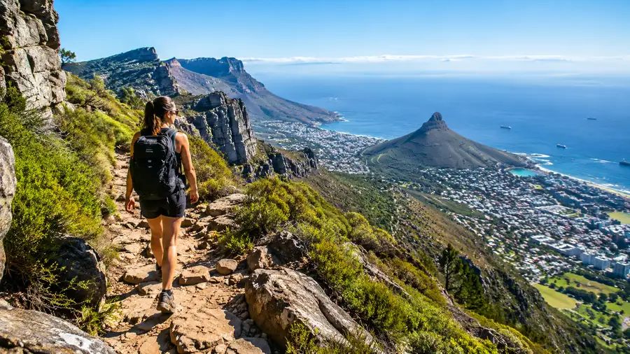
The perspective shifts constantly. One minute you are looking directly into the shadow of the sheer cliffs under the upper cable station, and twenty minutes later you turn a corner around Venster Buttress onto a sun-baked ledge overlooking the Twelve Apostles and the blue expanse of the Atlantic. It feels wild, even though you are never more than two kilometers from a suburban espresso bar.
Route Breakdown: From Lower Cable Station to the Upper Plateau
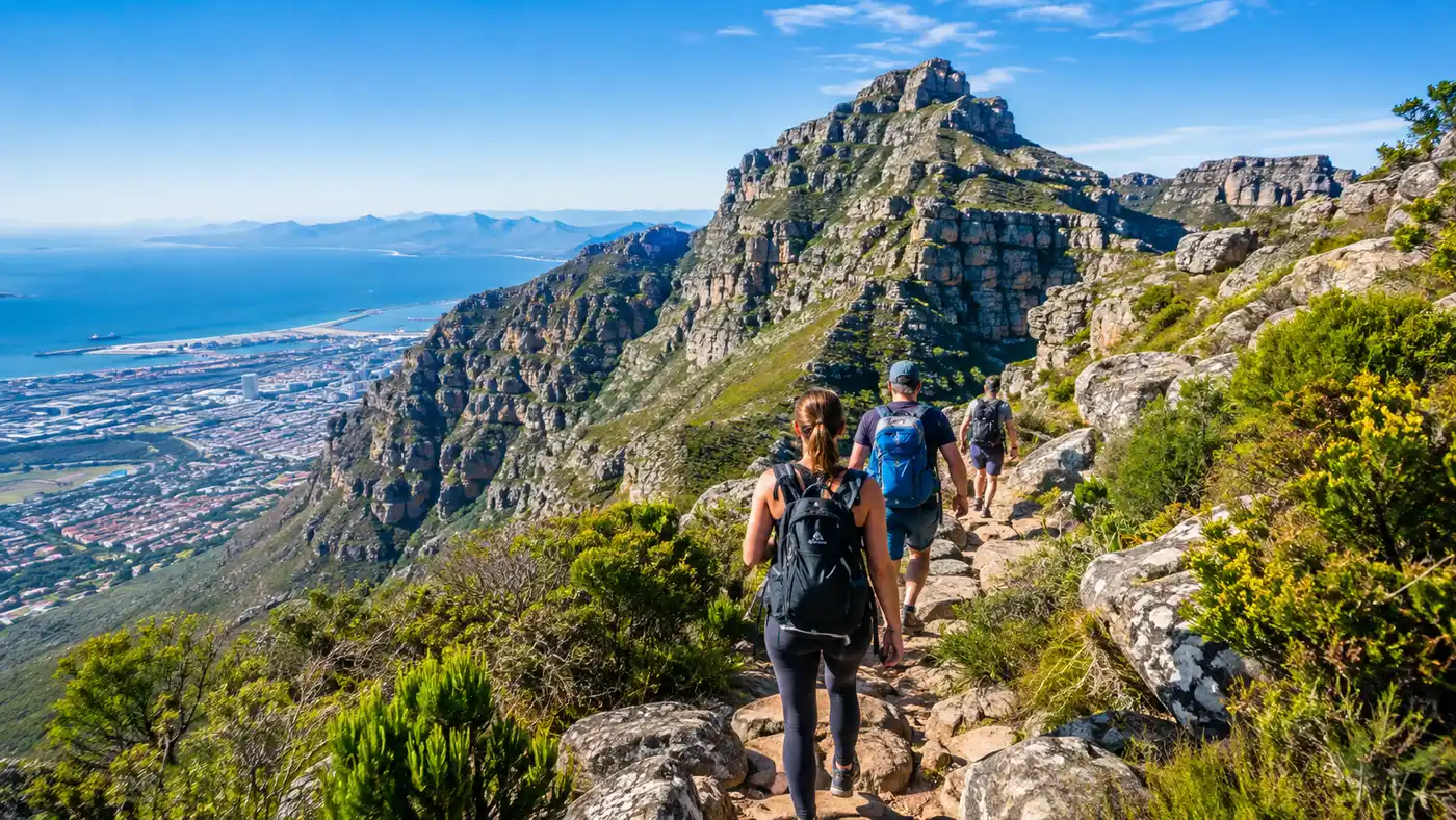
The journey starts quietly behind the Lower Cable Station on Tafelberg Road. You walk up the tarred road past the bus turning circle and pick up the stone trail branching off to the right. The first twenty minutes test your calves on steep stone steps, winding through low fynbos. It feels like any other Cape Town walk until you hit the Contour Path junction. Turn left, follow the path briefly, and then look for the blue spray-painted signs and yellow footprints pointing directly up the fall line.
This middle third is where the character of the india venster hiking trail changes completely. The dirt trail dissolves into chunky boulders. You enter the ravine beneath the cable car cables, stepping over loose scree and scrambling up short rock steps. The sound of city traffic drops away, replaced by the wind funneling through the gorge and the occasional metallic scrape of the cable car passing overhead.
Pro tip: Look for the bright yellow spray-painted footprints on the rock faces. Whenever the route seems to vanish into an impassable boulder field, those yellow marks show the exact handholds and foot placements locals use.
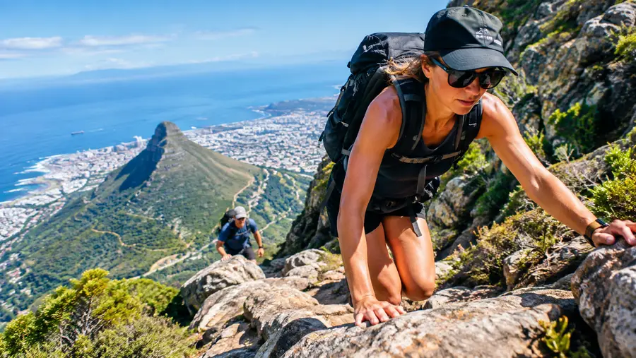
Around halfway up, you reach the crux. This is the section with metal staples driven deep into the grey sandstone. You pull yourself up an eighty-degree slab with plenty of air beneath your boots. It looks intimidating from the bottom, but the metal rungs are thick and secure. Once through the chains, the trail skirts west beneath the main cliffline, crossing narrow ledges before joining the upper section of the Fountain Ledge route to top out near the cable station.
The transition from empty mountain to civilization at the summit is jarring. You scramble over a final lip of rock, pull your pack off, and suddenly you are standing on a paved concrete pathway surrounded by tourists wearing linen shirts and flip-flops. It takes a second to adjust.
Scrambling, Chains, and Exposure on the India Venster Trail
People often ask how hard is the Table Mountain hike when discussing this trail. The answer depends entirely on your relationship with heights. Physical stamina gets you up the hill, but mental composure gets you through the exposed steps. If standing on a two-foot ledge with a two-hundred-foot drop beside your left elbow makes your stomach turn, you will not enjoy the upper third of the india venster route.
There are three distinct scrambling sections. The first involves a short scramble up a chimney feature with decent natural footholds. The second is the chain section, where steel staples provide ladder rungs across an awkward bulge in the rock. The third is an exposed traverse along a narrow contour line that wraps around the western flank of the mountain toward Camps Bay.
| Route | Distance | Elevation Gain | Exposure Level | Scramble Required |
|---|---|---|---|---|
| India Venster | 3.8 km | 720 m | Moderate to High | Yes (chains/staples) |
| Platteklip Gorge | 2.9 km | 700 m | None | No (steep stone steps) |
| Skeleton Gorge | 6.2 km | 930 m | Low | Mild (wooden ladders) |
None of the climbing moves are technically difficult. If you can climb a playground ladder and step across a puddle without falling, your body possesses all the physical coordination needed. The challenge is psychological. Your brain knows you are high up, and the wind on the front face can gust unpredictably. Take each step deliberately, keep three points of contact on the steep rock, and never rush past another hiker on narrow ledges.
I have seen fit runners freeze completely at the first staple because their fear of heights took over. If you feel panic setting in early during the lower scrambles, turn around immediately. The route becomes significantly more exposed as you go higher, and retreating from the upper ledges is dangerous.
Book your hiking tours cape town experience:
Essential Safety Tips for the India Venster Table Mountain Hike
Table Mountain creates its own weather system, and it does so in about fifteen minutes. You can start the indian venster hike under a cloudless blue sky and find yourself enveloped in thick grey mist halfway up the rock face. When the notorious south-easterly wind blows, it pushes moist marine air over the back of the mountain, creating the famous "tablecloth" cloud. On India Venster, that cloud brings howling winds, wet and slippery rock, and near-zero visibility.
Note: Never attempt to hike down India Venster. Reversing the scrambles and descending the steel chains without seeing your foot placements is extremely dangerous, which is why mountain rescue responds to so many stranded hikers on this face.
Knowing whether is Table Mountain safe for hiking comes down to preparation and route choice. The front face is notorious for rescues because casual walkers mistake this track for a scenic stroll. To finish safely, keep these basics locked down:
- Footwear with genuine grip: Smooth running shoes will slide on dusty sandstone slabs, so wear shoes with sticky rubber soles or trail tread.
- Water reserves: Bring at least two liters per person since the front face catches direct morning sun and radiates heat like a brick oven.
- Warm layers in your pack: Pack a windbreaker even on hot days because the temperature drops ten degrees at the summit plateau.
- Offline navigation: Download an offline topographic map before leaving your accommodation because cellular signals drop along the cliff bases.
- Emergency numbers saved: Save the Metro Wildfire and Mountain Rescue dispatch number (+27 21 937 0300) directly into your phone.
Solo hiking on this specific trail is generally discouraged. While muggings are rare on this sheer cliff line compared to lower suburban contour paths, an ankle sprain on these ledges leaves you in a very awkward spot. Going with a partner means someone can assist with handholds or call for help if things go sideways.
Logistics, Timing, and Descending the Mountain
Plan for roughly three to four hours to reach the summit, assuming a steady pace with water breaks. Very fit mountain runners clock it in ninety minutes, while groups taking photos and managing nerves on the chains can easily spend four and a half hours on the rock. Starting early is non-negotiable between November and March. By 9:30 AM, the sun hits the front face directly, turning the rock gullies into an oven.
Parking along Tafelberg Road fills up before breakfast on summer weekends. Park your car roughly two hundred meters past the Lower Cableway station, or better yet, take an Uber directly to the station steps. That saves you from walking up the steep tarmac hill before the trail even begins.
- Start time: 6:00 AM to 7:00 AM during summer months to beat the blistering midday sun.
- Cableway descent: Buy a one-way ticket down (around R280 to R340 depending on season) if you want to save your knees.
- Walking descent: Walk down Platteklip Gorge if the cableway shuts down due to high wind speeds.
- Total distance: Roughly 3.8 kilometers up, ending at 1,067 meters above sea level.
Always check the cableway operating status on their website before lacing your boots. If the cable car is closed due to wind, remember that you must walk down the mountain. Your descent route should be Platteklip Gorge, which adds another two hours of knee-jarring stone stairs to your day. Never try descending via the india venster trail to get back to your car faster.
Frequently Asked Questions about india venster hike
Can beginners do the India Venster hike?
No, this trail is not suitable for beginner hikers. It requires scrambling skills, comfort with steep drops, and the ability to pull your body weight up rock faces using metal staples and chains. Beginners should tackle Platteklip Gorge or Lion's Head first.
Why is it called India Venster?
The name comes from two rock plates near the middle section that frame an opening resembling a window (venster in Afrikaans). Early climbers thought the shape of the opening looked like the map of India.
Can you hike down the India Venster route?
You should never descend India Venster. Reversing the steep rock scrambles and climbing down the staples without visible footholds has caused numerous fatal falls. Descend via the cableway or walk down Platteklip Gorge.
Do I need climbing ropes or a harness?
Technical rock climbing gear is not required for the standard trail. The route is an assisted scramble equipped with permanent metal staples, chains, and steel grips embedded into the rock at the steepest points.
Quick Reference
- Distance: 3.8 kilometers one-way
- Ascent time: 3 to 4 hours
- Elevation gain: 720 meters
- Difficulty: Advanced scramble (Grade B)
- Descent: Cableway or Platteklip Gorge only
Book your hiking tours cape town experience:
The Bottom Line
If you have reasonable fitness, solid boots, and an appetite for scrambling, the India Venster route rewards you like few other trails in South Africa. It turns what could be a routine uphill hike into a genuine mountain adventure right above the Atlantic. Just check the wind forecast, start at first light, follow the yellow footprints, and take your time on the chains.
Read more about hiking tours cape town.